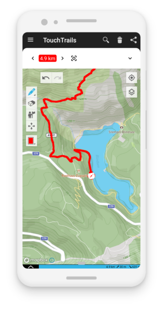
TouchTrails The route planner at your fingertip With TouchTrails, you can easily plan routes, track trails, and navigate in nature — perfect for hiking, running, and cycling.Simply draw routes and trails on the map with your finger and export them as GPX files. Measure Distances How far did you go last time?With TouchTrails, you can quickly measure distances directly on the map. Explore Elevation Profiles Planning a bike tour or a mountain hike?View elevation profiles and check how many climbs are ahead. View Trails Exploring new terrain?Import routes from various sources and find your way with ease. Route Planner Want to plan your next adventure?Create custom routes and trails with your fingertip. Import & Export GPX Files Import and combine as many GPX files as you want — perfect for merging trails or building complex routes. Everything at Your Fintertip Draw, edit, erase, and merge trails with intuitive gestures directly on the map. Go Offline Download offline map tiles and use TouchTrails anywhere — even without an internet connection. Partners