New Zealand > Otago > Mount Aspiring National Park > Routeburn Track
Routeburn Track
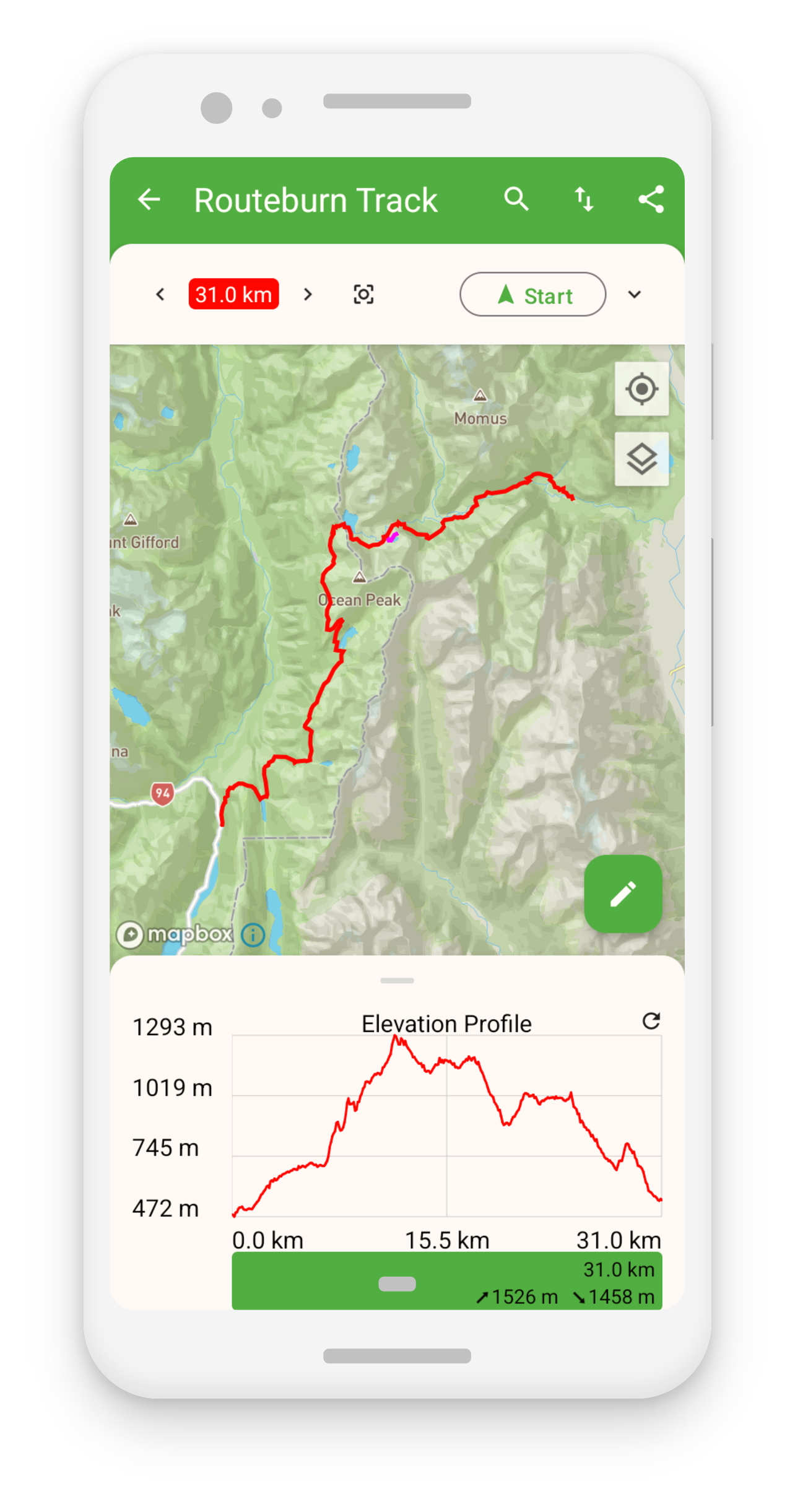
The Routeburn Track is a 32 km hike that takes hikers through stunning alpine and beech forest, and offers views of the Mount Aspiring National Park. The track is located on the South Island of New Zealand and is considered one of the most popular and scenic hikes in the country. The hike can be completed in 2-4 days and is suitable for hikers of moderate fitness.
The hike begins at the Routeburn Shelter, where you’ll take a scenic drive to reach the trailhead. The track takes you through lush rainforest, past cascading waterfalls, and alongside crystal-clear mountain streams. Along the way, you’ll have the opportunity to spot native New Zealand wildlife, including the Kea parrot, and to enjoy the stunning views of the surrounding mountains and valleys.
The track is divided into two sections: the Routeburn section and the Greenstone section. The Routeburn section is considered to be the more strenuous of the two, while the Greenstone section is relatively easier. The Greenstone section offers great views of the Greenstone Valley and the surrounding mountains. The highlight of the hike is the panoramic views of the Routeburn Flats and the alpine landscapes along the way.
The Routeburn Track is a great hike for those looking to experience the natural beauty of New Zealand while getting a moderate level of physical activity. It’s important to be well-informed and prepared before starting the hike, and to follow the safety guidelines.
Install the TouchTrails app via this link on your Android phone.
The app will then show you the Routeburn Track directly on your Android device. The elevation profile is included and you can also export it as a gpx file.