Elevate your route creation prowess through these precision tools, ensuring your paths align flawlessly with your intentions.
Draw Routes Freehand
To inaugurate a new route, leverage the “Draw New Routes” tool  .
.
Glide your finger across the map to intricately chart your course. This tool empowers you to craft multiple routes, each distinguished by a unique color (see Color Selector), on a single map.
For continuous route extension, entrust the “Draw Routes” tool  . Simply grasp an endpoint and drag it across the map.

Straight Line Mastery
The “Draw Routes” tool  also allows you to draw straight lines. By engaging and holding anywhere on the map, create impeccable straight lines from your active endpoint to the selected position. Refine the line’s orientation by guiding it with your finger. Activation of another endpoint is effortlessly achieved through a simple tap.
Snap to Road
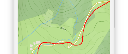
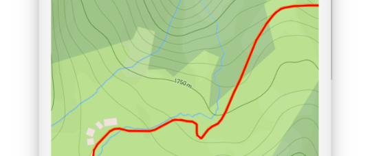
Optimize route accuracy with the “Snap to Road” tool  . When activated, your routes seamlessly adhere to the nearest road or trail, granting effortless creation even along intricate footpaths.
Witness the distinctiveness between deactivated (left) and activated (right) Snap to Road:


Combine Routes
Embrace the art of route combination. As your route concludes close to another, TouchTrails extends a query: Merge or maintain separation? This feature proves invaluable for effortlessly amalgamating routes from various GPX files.

Track your GPS location
For an elevated route creation experience, GPS tracking holds promise. Explore the realm of GPS tracking for dynamic route generation (see GPS Tracking).
